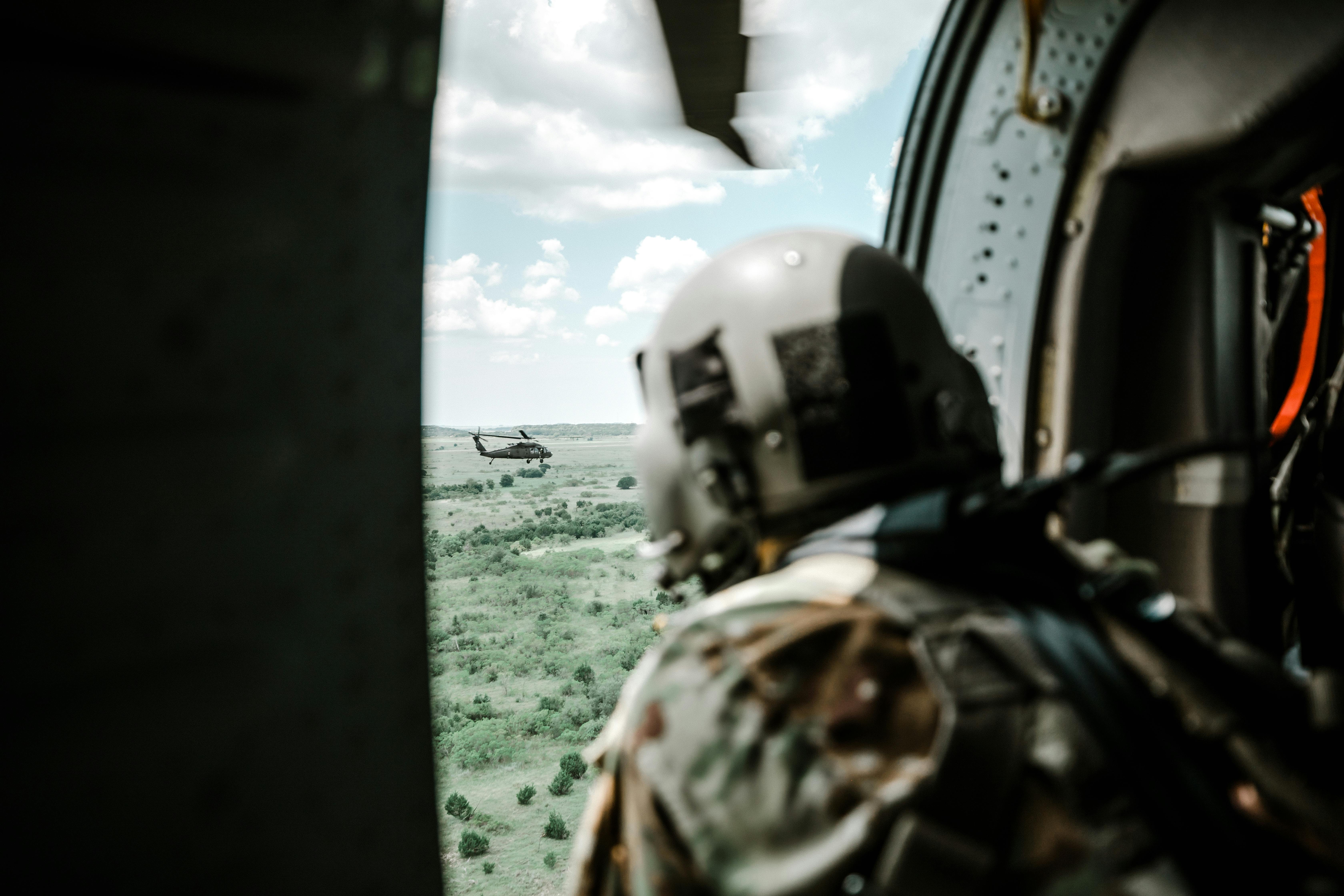
AVAILABLE FOR DEPLOYMENT
© 2026We craft strategic solutions built for the field. Each detail balances precision and performance for real-world impact. Our expertise adapts to every mission, force, and frontier.

WHO WE ARE


2026


UMTCD
Airmobile Command
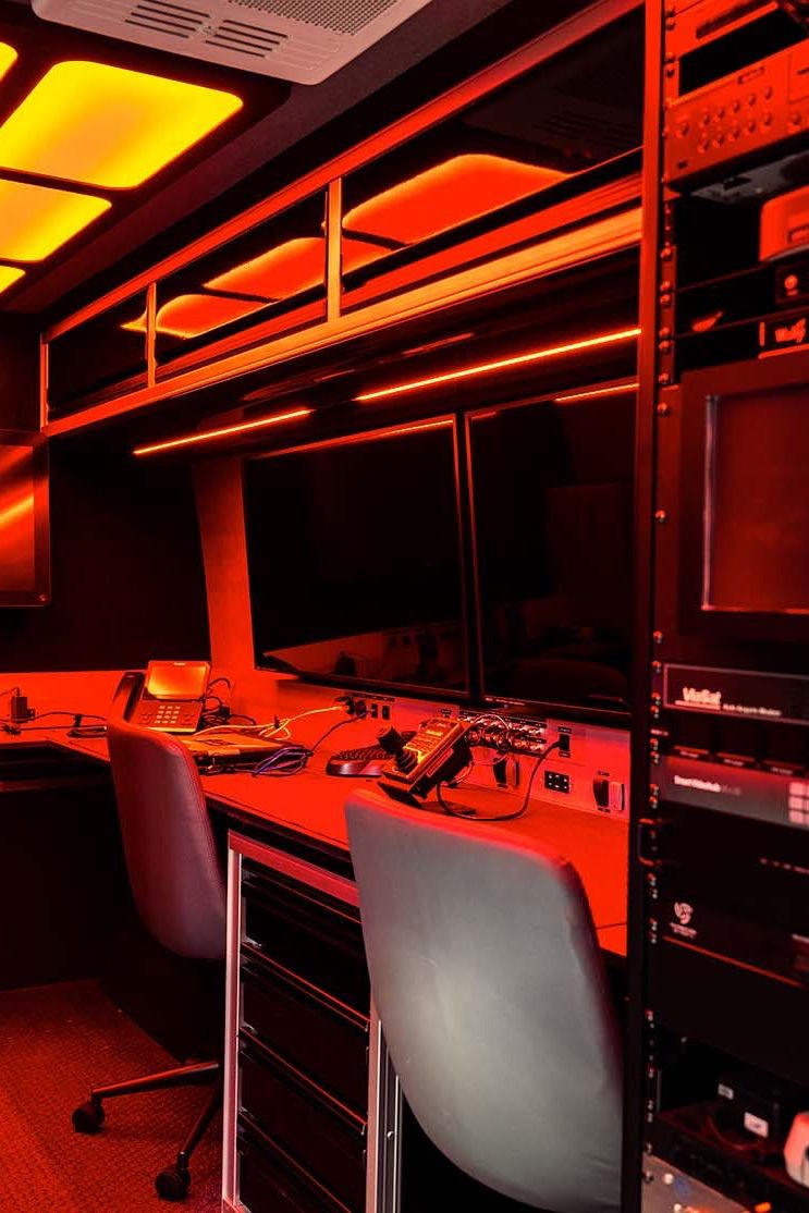
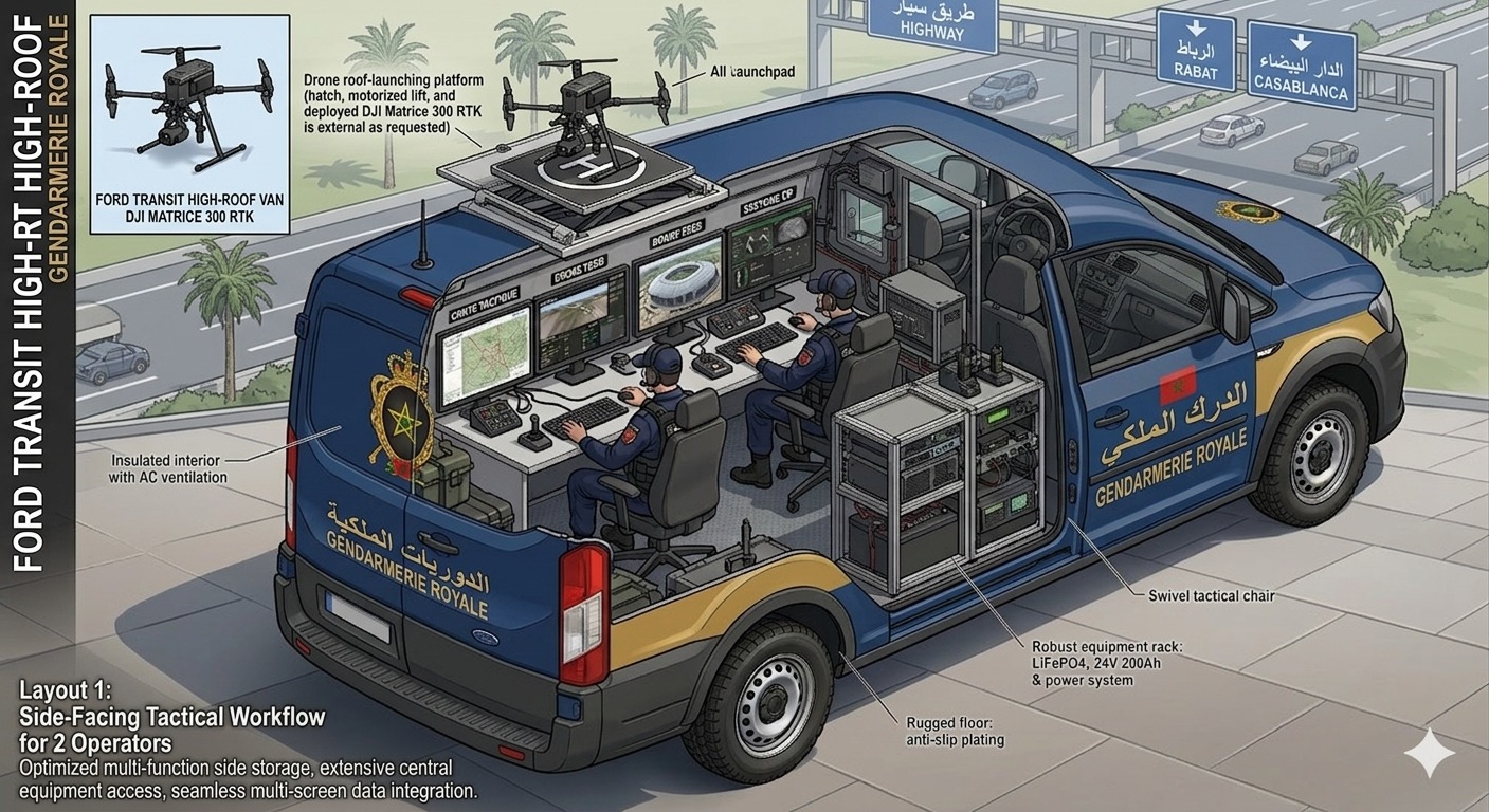
The UMTCD delivers a fully autonomous mobile command post — deployable in minutes, operable 8 hours off-grid, and capable of coordinating multi-agency operations without fixed infrastructure.
- // Tactical Operations Console
- // 8h Off-Grid Autonomy
- // Multi-Agency Coordination
- // Hardened Linux OS
- // Real-Time Tactical Mapping
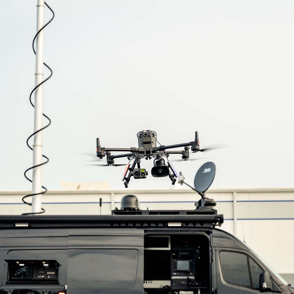
Drone Surveillance
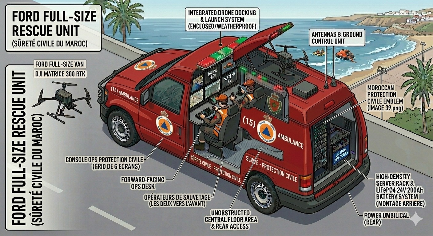
Integrated DJI Matrice 300 RTK with dual thermal/optical payload, automated launch and landing, and encrypted 15km video feed — delivering real-time aerial intelligence to any command center.
- // DJI Matrice 300 RTK
- // Thermal & Optical Payload
- // Automated Launch & Return
- // 15km Encrypted Video Link
- // Waypoint & Orbit Modes

Secure Communications
End-to-end encrypted communications across TETRA, LTE, WiFi 6, and Starlink satellite — ensuring uninterrupted command links for Gendarmerie, DGSN, and Civil Protection in any environment.
- // TETRA P25 — AES-256
- // LTE / Starlink Backup
- // VPN IPSec Tunnels
- // Inter-Agency Data Sharing
- // WiFi 6 On-Site Network
The Process


Assess the Terrain
before the mission begins
We begin with a full operational audit — identifying the agency's needs, threat environment, and deployment requirements. Every decision starts with clear intelligence.

Engineer & Integrate
with precision and rigor
The UMTCD is assembled through a rigorous 8-stage production process — from vehicle fitting and drone integration to full system validation and field testing.

Deploy & Support
beyond the handover
Operators receive a certified 40-hour training program. Post-delivery, MSS ensures continuous MCO support — maintenance, upgrades, and 7/7 technical assistance.
CORE SYSTEMS
-
DJI Matrice 300 RTK
Aerial Layer
DJI Matrice 300 RTK
Aerial Layer
DJI Matrice 300 RTK
Aerial Layer
DJI Matrice 300 RTK
Aerial Layer
-
TETRA P25
Secure Comms
TETRA P25
Secure Comms
TETRA P25
Secure Comms
TETRA P25
Secure Comms
-
NVIDIA Jetson AGX
AI Processing
NVIDIA Jetson AGX
AI Processing
NVIDIA Jetson AGX
AI Processing
NVIDIA Jetson AGX
AI Processing
-
LiFePO4 400Ah
Power System
LiFePO4 400Ah
Power System
LiFePO4 400Ah
Power System
LiFePO4 400Ah
Power System
-
QGIS + PostGIS
Tactical Mapping
QGIS + PostGIS
Tactical Mapping
QGIS + PostGIS
Tactical Mapping
QGIS + PostGIS
Tactical Mapping
// Units Deployable
10 h
Continuous autonomous
operational autonomy
// Threat Detection Rate
10 %
AI-assisted accuracy
in live field conditions
// Deployment Readiness
1 min
From arrival to fully
operational on any terrain

Frequently
asked questions
What exactly is the UMTCD and what does it do?
The UMTCD is a mobile, autonomous tactical command and defense unit mounted on a ruggedized vehicle. It integrates aerial surveillance, secure communications, AI-assisted threat detection, and real-time mapping into a single deployable system.
Who is the UMTCD designed for?
The UMTCD is built for law enforcement agencies, gendarmerie units, border security forces, and civil protection services requiring rapid deployment in complex or hostile terrain.
How long does deployment and setup take on the field?
The UMTCD is designed for rapid operational readiness. Once on site, the system can be fully operational within minutes, requiring minimal setup thanks to its integrated plug-and-play architecture.
Does the system operate in GPS-denied or low-connectivity environments?
Yes. The UMTCD is engineered for full offline autonomy. It operates via a local mesh network and onboard processing, ensuring continuous mission capability even without satellite or internet connectivity.
What training is required to operate the UMTCD?
MSS provides a certified 40-hour operator training program covering system deployment, drone operations, communications management, and emergency protocols. Training can be conducted on-site or at our facility.
Is post-delivery maintenance and support available?
Absolutely. MSS offers full MCO contracts — maintenance, corrective servicing, and operational upgrades — with 7/7 technical support to ensure your unit remains mission-ready at all times.